
Sun weather coverage
From Green Valley to Summerlin, light snow and sleet fell across the Las Vegas Valley today as an unseasonable cold spell settled over Las Vegas.
There have been no reports of any snow accumulating in the valley, the National Weather Service said. A few showers moved southeast across the Las Vegas Valley between 6 a.m. and 7 a.m. Wednesday, producing the first reports of snow on the west and southwest sides of the valley.
Snow showers also were reported between about 1:30 to 1:45 p.m., the weather service said. The snow showers fell at elevations as low as 2,000 and 3,200 feet.
No snow has been reported at McCarran International Airport, the official climate station for reporting weather in Las Vegas, the weather service said. "So officially, so far, there was no snow in Las Vegas," forecasters said in a statement.
The latest snow that has ever been reported in official Las Vegas climate records was on April 4, 1958, in the form of snow pellets. The latest that snow flakes have ever fallen in Las Vegas, based on official records, was March 14, 1975.
Traces of snow later in March have been reported, whether snow pellets or hail, and they count as a trace of snow, the weather service said.
The earliest and latest dates snow has ever been reported in the valley may be this season, the weather service said. Back on Oct. 11, 2008, snow was observed briefly in Summerlin.
The strongest gust of wind recorded in Southern Nevada on Tuesday was a 75 mph gust in the Desert National Wildlife Reserve, northeast of Las Vegas, the weather service said.
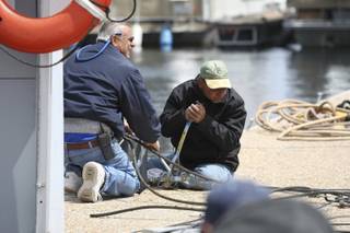
Heavy winds Tuesday evening damaged the Las Vegas Boat Harbor at Lake Mead, but the harbor's owner said things could have been much worse.
Harbor owner Betty Gripentog said winds pushed the marina apart, but beyond the cosmetic aspect, the damage was minor.
"I've seen worse," Gripentog said. "It's hard to gauge because everything looks bad when the dock pulls apart."
Winds gusting more than 70 mph tossed canvas covers and knocked boats into one another, scratching them, Gripentog said.
"Fortunately, no one was out on the water," Gripentog said. "People who were on their docked boats were safe."
National Parks Service spokesman Andrew Munoz said the Callville Bay Marina sustained similar damage, but it had all been repaired this morning.
"The way the marinas are designed is they're anchored to the bottom of the lake and a couple of them are covered, so there's a bit of a sail for the wind to catch and create some movement."
Munoz said a high-wind day on the lake usually means gusts about 30 to 35 mph, so Tuesday's gusts exceeding 50 mph were rare.
Gripentog said some boats at the harbor sustained minor damage to their sails, but none were sunk. As the winds died down this morning, she said, her employees were already working on pushing the marina back together.
Munoz said the Park Service isn't placing any restrictions on the lake, but warned boaters to exercise caution.
"We always advise boaters to check the weather and make sure the boat they are going out on is appropriate for those conditions," he said. "When the winds kick up, it can get choppy out there."
The weather service recorded wind gusts of 50 to 55 mph throughout the Las Vegas Valley during the height of the storm Tuesday evening, with gusts as high as 63 mph at Nellis Air Force Base and 61 mph at Red Rock Canyon.
The National Weather Service said 5 inches of snow were on the ground at the fire station on Mount Charleston and a foot of snow blanketed the Mount Charleston Lodge overnight.
Although there were reports of snow flurries and sleet in Las Vegas, from the Stratosphere Tower at Sahara Avenue and Las Vegas Boulevard South to Summerlin, April 15 is officialy snowless, according to the weather service.
Unless snow falls at McCarran International Airport, where the weather service gathers its official climate records, seeing snow doesn't count, a meteorologist explained today.
As a mass of cold air sat directly over Nevada this morning, it didn't take a weather forecaster to tell Las Vegas residents and visitors that unseasonably cold weather had returned.
"Today will be a lovely January day in the middle of April," weather service forecasters said after measuring temperatures and winds at the airport this morning.
Meteorologist Chris Stachelski said he didn't expect to see such heavy winds today.
"The winds are pretty much done with," he said. "They pretty much shut down when the showers ended about 10 p.m."
Throughout the valley, the winds caused little trouble. Metro and Henderson Police department said they received no wind-related calls for service.
NV Energy spokesman Adam Grant said the winds created brief, spotty power outages throughout the valley, but the only extended outage occurred on Mount Charleston and affected about 500 customers.
The wintry blast is expected to keep Las Vegas 20 degrees or more below normal temperatures. While normal temperatures for this time of year range from 78 degrees for daytime to 54 degrees at night, Las Vegas could tie or break the coldest temperature records for Wednesday and overnight, forecasters said. The chilliest afternoon high temperature recorded on April 15 was set in 1998 at 56 degrees, and the record low of 39 degrees on April 16 was also set in 1998.
There is a 30 percent chance of showers in the valley today, with temperatures expected to reach only the upper 50s, forecasters said. The continued cold air mass overnight could drop temperatures into the upper 30s to low 40s, they said.
As the cold air begins to move east of Nevada, the best chance for snow accumulating is in Lincoln County, north of Las Vegas, and northwestern Arizona, as well as the Spring Mountains to the west, including Mount Charleston, and the Sheep Mountain range, north of the valley, the weather service said. Where the air is coldest the snow level will drop to 3,000 feet, forecasters said.
Before the coldest air arrived on Tuesday, weather forecasters in Southern Nevada recorded thunderstorms mainly over Pahrump, 60 miles west of Las Vegas, and the Nevada Test Site, 65 miles northwest of the city. They also reported some sprinkles of rain and haze in the valley.
After Wednesday's winter display, north winds will persist on Thursday, allowing the valley to gradually warm up over the weekend until above-average temperatures arrive early next week. By Monday Las Vegas could record its first 90-degree day and Death Valley in Southern California could hit 100 degrees for the first time this year, both temperatures about 10 degrees above normal in this wild weather ride.
Join the Discussion:
Check this out for a full explanation of our conversion to the LiveFyre commenting system and instructions on how to sign up for an account.
Full comments policy