
As traffic safety enforcers and experts try to solve the countywide problem of crashes and fatalities, others are taking a closer look at what makes some Valley roads more dangerous than others and what safety measures can be implemented to reduce deaths.
A UNLV Center for Crime and Justice study analyzed Metro crash data and found there were 21,943 reported crashes across 5,171 intersections in 2018. Almost 12,000 of these crashes resulted in an injury and 138 were fatal. While intersection fatalities were widely distributed throughout Clark County, injury-related crashes were heavily concentrated across 20 intersections.
In Clark County, the intersection with the most crashes is Sahara Avenue and Decatur Boulevard, according to the UNLV study. In 2018, 54 injury crashes were recorded there. That’s about one per week.
“Sahara and Decatur is a problem,” Metro Lt. Gregory Munson said. “That intersection wasn’t designed to handle the amount of traffic it gets.”
Distracted driving also plays a huge role.
“They’re stuck in traffic, now they’re making the phone calls, they’re doing 10 things in their car at once instead of driving,” he said.
But intersections with the most crashes don’t always mean they’re the most dangerous.
According to Craig Raborn, Manager of Planning at the Regional Transportation Commission of Southern Nevada, most research shows that it’s actually extremely difficult to predict where crashes will happen.
That’s why traffic experts and engineers in Southern Nevada are looking into characteristics of certain roads that may increase the overall risk of a crash.
Characteristics may include higher speed limits, which shorten a driver’s ability to react quickly. Higher traffic volumes and driveway access points before or after intersections also factor into higher crash rates.
The Boulder Highway problem
According to data from Metro, Clark County had 226 traffic fatalities in 2018—the highest in a decade. Of those fatalities, a quarter of them involved pedestrians.
This year, pedestrian deaths are up almost 20 percent from 2018, according to figures from the Nevada Department of Public Safety.
Erin Breen, coordinator with the Traffic Safety Coalition, said a tenth of pedestrian fatalities occur along Boulder Highway.
She calls the area near the Boulder Highway, Nellis Boulevard and Flamingo Road intersection the “trifecta of doom.”
“You have two major streets bisecting another major street in this vast right of way,” she said.
The Nevada Department of Transportation reported 214 crashes at Nellis and Boulder between 2015 and 2017. Of those crashes, 128 of them resulted in injury and six were fatal. Nearby at Flamingo Road and Boulder Highway, NDOT reported 218 crashes. Of those crashes, 133 resulted in injury and five were fatal.
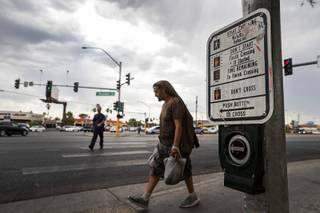
One of the issues at those intersections, Breen said, is that the pedestrian crosswalks are purposefully timed so the pedestrian can only get halfway across the street. The idea behind this design is to have the pedestrian wait in the middle of the intersection before crossing again.
“Human beings don’t do that,” Breen said. “People push it and try to make it all the way across the street. … It’s a spot where I feel particularly bad for the drivers because—especially at night—you can’t see the pedestrian.”
The speeds on Boulder Highway also make intersections such as Nellis and Flamingo particularly dangerous because drivers don’t have enough time to slow down for pedestrians.
Breen said another problem with Boulder Highway is that it’s only designed to move cars but doesn’t take into account the amount of daily foot traffic.
Raborn said one of the biggest issues around Boulder Highway is how the community has changed. In the beginning, it was largely rural.
“When Boulder Highway was originally built in the 1930s, it was a highway,” he said. “People would use it for the drive to Boulder City as a highway between Las Vegas and Henderson.”
Today, Boulder Highway is used for short, local trips. Raborn said the average trip distance is about two miles.
This results in a “mismatch” of use.
Breen agrees and argues that Boulder Highway should really be called “Boulder Boulevard.”
Solutions
Despite Boulder Highway’s flaws, it still has great potential, Breen said.
The effort to rethink the area has been a grassroots one, including traffic experts and residents.
According to the RTC, a reimagined Boulder Highway could incorporate more pedestrian facilities, bicycle access and transit services.
NDOT completed $1.5 million in pedestrian safety improvements at eight locations along the roadway so far.
The Boulder Highway and Sun Valley intersection is one of those sites.
In 2015, it was the deadliest intersection in the state. Twelve pedestrians died, as well as four individuals in vehicles.
This prompted the county to add a crosswalk. That still didn’t mitigate pedestrian fatalities, so the crosswalk was later configured to have a curbed refuge island—also called a “Danish offset” design—in the middle.
“Instead of just blindly walking straight across the street, it purposefully turns you in the center of the intersection, so that you’re facing traffic.” Breen said. When pedestrians are facing traffic, they are more likely to avoid cars.
Since the crosswalk improvements, there have been no traffic fatalities, she said.
Breen added that other crosswalks have been installed along Boulder Highway’s intersections and midway crossings.
“Just those improvements are going to help fatalities on Boulder immensely,” she said.
This story originally appeared in the Las Vegas Weekly.